

Al Murshid - iPad Version app for iPhone and iPad
Developer: The Centre for GIS - MMUP
First release : 18 Dec 2014
App size: 120.47 Mb
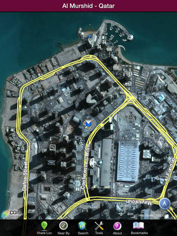
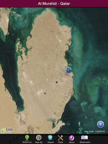
A bilingual (Arabic/English) iOS app developed by The Centre for GIS - Ministry of Municipality & Urban Planning - State of Qatar. As the meaning of its name in Arabic implies, Al Murshid guides its users through geospatial related services and displays Aerial/Satellite imagery and vector maps for streets, street names, landmark symbols for the State of Qatar and provides the following services:
- Search/Locate address through Qatar Area reference (QARS) address data i.e. Building Number, Street Number, Zone Number.
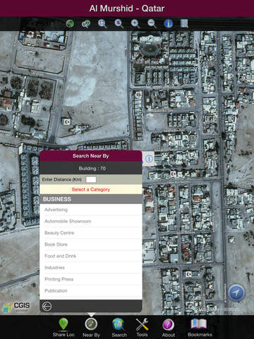
- Search/Locate Landmarks (POIs) by entering whole or part of landmark name.
- Search/Locate Geographic names through entering whole or part of Geographic name.
- Search/Locate a user personal geographic bookmarks.
- Marking and tracking current user location.
- Spatial query and distances for landmarks from either current location or selected landmark.
The new version is designed specifically for iPad and a new version for iPhone will be released soon. This version was completely redesigned with the following additional functionalities:
- Searching and locating Parcels Identification Numbers "PIN".
- Searching and locating Zones, Districts and streets.
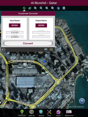
- Locating coordinates.
- Coordinates conversion between Qatar National Grid "QND95" and "WGS84" and vice-versa.
- Landmark identification with photographs.
- Map drawing according to predefined selectable scales.
- Tools for map navigation.
- Problem reporting related to addresses and landmarks.